
Building Measurement Services
Laser-accurate as-builts, floor plans, and area calculations you can rely on for leasing, design, and compliance.
- As-built surveys and floor plans
- BOMA-aligned area calculations
- CAD and BIM-ready deliverables
Building Measurement • Reality Capture • Digital Twins
We combine accurate reality capture with friendly, expert guidance so owners, architects, and contractors can trust every measurement and move projects forward with confidence.

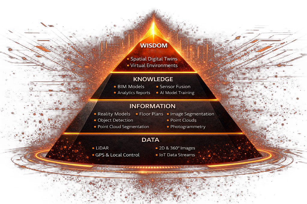
Our DIKW framework guides how we transform your spatial data into strategic advantage.
Trusted by teams across
Services
Four focused services that work together to capture your buildings, digitize them, and turn that data into smarter decisions.
Laser-accurate as-builts, floor plans, and area calculations you can rely on for leasing, design, and compliance.
High-fidelity 3D laser scanning and LiDAR to document every surface, system, and edge of your built environment.
Interactive digital replicas of your sites and assets so teams can explore, measure, and plan from anywhere.
Turn spatial data into clear insights about utilization, risk, and investment so you can act with confidence.
Our Process
Share project details, drawings, and goals. We confirm scope, advise on the right services, and send a clear quote.
Our field team captures your space with LiDAR and proven workflows designed to minimize disruption and maximize coverage.
We process point clouds, build accurate models, and perform the measurements and analytics your project requires.
Receive CAD/BIM files, digital twins, and reports in your preferred formats—plus a walkthrough to make sure everything is clear.
Ready when you are
Share a few details and we’ll respond with a clear, no-pressure quote and timeline.